The La Thuile ridges

Medium
3h
9km
Loop
+326m
-326m
The La Thuile ridges image1The La Thuile ridges image2The La Thuile ridges image3The La Thuile ridges image4The La Thuile ridges image5The La Thuile ridges image6The La Thuile ridges image7The La Thuile ridges image8The La Thuile ridges image9The La Thuile ridges image10The La Thuile ridges image11
1 / 11

Description

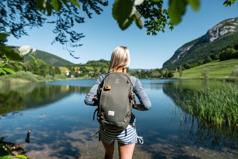
What a lovely start to this hike, with a view of the wonderful little lake of La Thuile, like a piece of blue sky falling at the foot of the mountains.

Arriving below the Roc de Tormery, the great landscape begins to appear.

From here on, you'll need to be careful not to be distracted by its magnificence. The Granier rises up in front of you; Chambéry and Lac du Bourget stretch out to the right. The Isère valley runs off to the left and the Bauges massif stretches northwards.

As you follow the ridge, the views follow one another without resembling one another, as you pass parks and rocks. Further on, the Albertville valley is in your sights.

Along the way, an orientation table will help you find your bearings and name all the peaks you can see in the distance.

Crossing the forest again, the path takes you back to the village. At the bottom, it skirts the lake, whose soothing view signals the return to the valley and the end of this magnificent journey.

Guided steps

Start: from the Salle des Fêtes parking lot in La Thuile.

1/ Turn left onto the road, and after 100m take a dirt track on the left.

2/ At the road, turn right and walk along it.

3/ Take the path on your right towards the Grotte de l'Ermite.

4/ At the edge of a field, go straight across. Enter a wood, climb up to a gate protecting access to a cottage.

5/ Take the right-hand path up to the ridge. At the top, walk along the fence.

6/ At the "Les combes Sud" sign, turn left towards "Roc de Tormery", and continue towards the Tormery cross.

7/ Follow the crest of the ridge, passing over rocks. Continue between meadows and woods, crossing several barriers.

8/ At the "Le Tapin-Ouest" sign, there are two possible routes: either to the right, a tricky cabled passage, or to the left, a forest path. The routes meet again at the "Sous Tapin" sign.

9/ Several successive foot-and-hand rock passages. Continue towards Roche du Guet.

10/ Continue along the ridges and start the descent. At the various intersections, follow "La Tuile".

11/ When you come to the houses, cross the hamlet and turn left towards "Le Mont".

12/ After 100 m, take a path on the right and walk along the Lac de La Thuile to reach the starting point.

Download GPX file
Address
Salle des fêtes, Route des Prés, 73190, La Thuile
Opening
From 01/05 to 31/10 daily. Subject to favorable snow and weather conditions.

Was this content helpful to you?