The Sauge Peak


Description
Fancy a nice hike in the Bauges off the beaten track? The Pic de la Sauge offers an ideal alternative for those who love slopes, rocks and beautiful scenery. Come and discover the secrets of this little-known summit.
The first kilometer of the hike won't require too much effort, but it's only after crossing the river that things get serious.
The trail leads into the Combe Noire, a remarkable beech-fir forest. It takes you under cliffs, from where a steep climb leads to the Rochers de Bévérau.
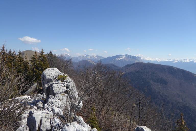
The magnificent scenery above is your reward. Below, the Lac de La Thuile nestles in the hollow of the mountains, and in the distance you can see Belledonne, the Chartreuse, and the Chambéry Valley overlooked by the Croix du Nivolet.
But the climb isn't over yet, and you continue on through a maze of rocks, looking for the yellow dots that point the way. A final steep climb takes you to the summit.
Here you're greeted by a cross and a second breathtaking view of Belledonne, the Chambéry Valley and the Bauges. Now you're invigorated for the descent.